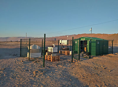
The Institute of Geophysics and Meteorology installed successfully a remote sensing station in the Atacama desert at the Airport of Iquique/Chile. The group of Integrated Remote Sensing under Prof. Susanne Crewell will use the data from this station to observe the Stratus Clouds which form as fog the main source for water along the Pacific coast of the Atacama. The instruments at the station allow to determine liquid water content of the clouds, their temperature, dynamics and vertical extension. The photo shows from left to right a Cloud Radar, a Doppler Wind Lidar and a Microwave Radiometer.
For more information click here ...
|
The site with (from left to rigth) cloud radar Joyrad94 , windlidar Halo Streamline (provided by FMI), Microwave radiometer FOGHAT. Photo: Mario Mech |


